Moderní technologie sběru dat v terénu
V současné době dochází ke stále rychlejšímu rozvoji informačních a komunikačních technologií. Nejinak je tomu i v oblasti geoinformačních technologií, které mají stále větší význam. Geoinformační technologie se objevují v různých oblastech lidské činnosti a dostávají se z kanceláří přímo do terénu. Tento rozvoj těží z rostoucí miniaturizace výpočetní techniky a z její integrace s komunikačními technologiemi. Rozvíjí se družicové systémy určování polohy a moderní metody získávání geodat.
Pro práci v terénu s geodaty je nutné vybavení · přenosným počítačem · připojeným GNSS přijímačem · potřebným programovým vybavením (geografickým informačním systémem).
Přenosné počítače
Pro práci s geodaty jsou samozřejmě optimální takzvané Tablet PC. Jedná se o plnohodnotné počítače s dominující plochou LCD obrazovkou – na první pohled větší PDA. Nicméně jednou z hlavních výhod oproti jiným specializovaným prohlížecím zařízením je univerzálnost daná běžným operačním systémem – Windows XP, Windows 7 s doplňky pro rozpoznávání písma. Místo na klávesnici píše uživatel perem na dotykový displej, kterým jsou všechna zařízení Tablet PC vybavena.
Levnější a mobilnější jsou kapesní počítače PDA (Personal Digital Assistant). Ve stručnosti se jedná o přístroj, který se svými rozměry vejde do kapsy, obsahuje klasické kancelářské aplikace, umožňuje synchronizaci s PC, napojení přes kabel nebo bezdrátové rozhraní na internet, mobil, fax, jednoduché ovládání pomocí dotykové obrazovky, možnost rozšíření programového vybavení, paměťových karet, klávesnice, modemu, různých zásuvných modelů např. GNSS (Global Navigation Satellite System, Globální družicový polohový systém) přijímač apod. Při výběru této části je nutné si ověřit, zda nabízený model podporuje Vámi zvolenou aplikaci a OS (Windows Mobile, Android, EPOC, jiný). Existují také speciální Tablet PC a PDA, které jsou odolné proti vlhku a nárazu. GNSS přístroj může být integrovaný přímo v přenosném počítači, připojen kabelem nebo přes bluetooth.
GNSS přijímače a přesnost
Při práci s GNSS přístrojem každého hlavně zajímá přesnost získané polohy. Ta záleží na tom, jaká technika měření je použita a jaký přístroj máme k dispozici. Předem je ještě důležité poznamenat, že přesnost u GNSS není pevná hodnota, jako je tomu např. u optických přístrojů. Protože GNSS využívá k výpočtu pozice signálu ze sítě družic, jejichž pohyb a změna parametrů dráhy jsou dynamické, dále tvar Země je nepravidelný, na Zemi dochází ke stínění signálu, atd., je přesnost u GNSS časově a prostorově proměnná. Poloha se totiž počítá tak, že anténa přijímače přijímá signál z viditelných GNSS družic, signál z družic je zpracováván, jsou identifikovány jednotlivé družice a počítány pseudovzdálenosti k nim. K výpočtu se používá metoda, kterou si lze představit jako prostorové promítání paprsků reprezentujících signál z jednotlivých družic do společného bodu někde na zemském povrchu nebo v jeho okolí. Aktuální pozice uživatele se odvodí z vypočtených vzdáleností k jednotlivým viditelným satelitům a ze souřadnic každé, pro výpočet použité družice v okamžiku vyslání signálu (tato informace je obsažena v signálu GNSS). Proto se v tomto případě přesnost udává s hodnotou mezní odchylky a pravděpodobností, s jakou nebude překročena. Např. okamžitá střední polohová chyba (50% všech měření) je u nejjednoduššího – kódového měření, které používají všechny komerční GNSS přijímače 5 – 10 metrů, u diferenčního měření, které již vyžaduje speciální vybavení, pak kolem 0,75 – 3 metrů.
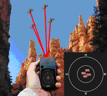
špatné rozložení družic GNSS
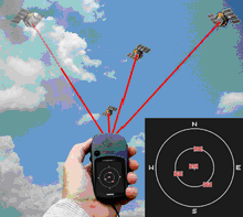
dobré rozložení družic GNSS
Pro měření samotné je potom určující zajištění co nejlepších podmínek. Existují programy pro plánování měření. Ty po zadání polohy určí čas, kdy bude rozložení družic optimální pro měření. Je také nutné zvolit přístroj GNSS, který bude garantovat určitou přesnost. O kvalitě GNSS přijímače vypovídá dnes především počet kanálů, které je schopen současně prohledávat. Méně než 12 kanálové se dnes na trhu většinou neobjevují a pro běžné použití jsou naprosto vyhovující.
GNSS čipy s označením SiRF mají několikanásobně vyšší citlivost při nižší spotřebě energie a umožňují tak příjem GNSS signálu i ve značně stížených podmínkách. Drobnou nevýhodou této technologie je, že se při prudké změně rychlosti nebo směru může projevit prodloužení času zpracování dat a tím dojde ke krátkodobé ztrátě signálu. Důležité je také zda GNSS přijímá kromě GPS také signál z ruského systému GLONASS a systému WAAS (Wide Area Augmentation System). Systém šíření diferenčních korekcí a monitorování integrity GNSS. V Evropě je nyní testován kompatibilní systém EGNOS (European Geostationary Navigation Overlay Service). Oba poskytují 95% měření s horizontální chybou menší než 3 metry. Pokud chceme dosáhnout ještě vyšší přesnosti je nutno použít takový GNSS přístroj, který umí přijímat korekční signál. Zeměměřický úřad například vybudoval celoplošnou sít permanentních stanic GNSS – CZEPOS, pokrývající celé území ČR. Je také vhodné použít externí anténu, protože pokud máme GNSS integrovanou v PDA přístroji, stíníme si tělem signál z některých družic. U některých GNSS přístrojů, jejichž využití je plánované spíše pro navigaci do automobilů, si musíme dát pozor na to, že mohou mít zabudovaný interní „filtr“ (vysílají změnu souřadnice, až pokud se pohybujeme vyšší rychlostí).
Geografické informační systémy TopoL
TopoL xT
TopoL xT je obecný geografický informační systém, který ovšem umožňuje tvorbu nadstavbových aplikací. Otevřenost systému při přístupu ke geografickým datům je zajištěna použitím modulární architektury vystavěné na bázi dle doporučení konsorcia OpenGIS. Toto pojetí umožňuje zpřístupnit data uložená v proprietárním formátu bez nutnosti jejich konverze. V současné době existují datové konektory pro stávající formáty TopoL BLK, ArcView Shapefile, Microstation dgn, MapInfo MIF/MID, MapInfo TAB, Geomedia MDB, Geomedia SQL, OpenGIS MDB, OpenGIS SQL, MISYS/Kokeš VYK, Oracle, AutoCAD dwg, dxf.
Program umožňuje provést připojení GNSS přístroje a provádět měření nebo navigaci. Lze si libovolně navolit info panel s údaji přicházejícími z GNSS. Při měření i navigaci na bod lze použít průměrování pro zpřesnění polohy.
TopoL Mobile
Program TopoL Mobile je levné GIS řešení pro navigaci a získávání dat v terénu pomocí GNSS. Tento program běží pod operačním systémem Windows CE, Windows Mobile na počítačích typu Pocket PC. Program může vykreslovat rastrová i vektorová data. Počet vrstev není omezen. Pracuje s vektorovým formátem ArcView Shapefile, a rastrovými daty ve tvaru MapLib. Tento typ rastrového souboru je možno vytvořit v TopoLu xT. Jedná se o jeden soubor, který může obsahovat libovolný počet jiných rastrů jako jednotlivé vrstvy. Tento způsob byl zvolen pro jednoduchost ovládání, které je v terénu obzvlášť důležité.
TopoL Mobile obsahuje nástroje pro připojení GNSS. Umožňuje zpracovat a zobrazovat veškeré dostupné parametry (počet a rozložení satelitů, kvalita signálu jednotlivých satelitů, azimut pohybu, HDOP, PDOP atd.). TopoL Mobile umožňuje navigaci na bod, automatický přesun mapy dle polohy GNSS a GNSS měření.
Při GNSS měření lze zvolit z několika způsobů registrace polohy. Registraci při přijetí každé nové polohy, registraci nové polohy po uplynutí doby, počtu přijatých záznamů nebo po uražené vzdálenosti, registraci jako průměr po uplynutí doby nebo počtu přijatých záznamů. Nová data mohou být ukládána jako ArcView shapefile nebo dxf soubor. TopoL Mobile umožňuje automaticky počítat délku linií a plochu polygonů. Při tvorbě nových objektů je možno vybrat z předdefinovaných šablon definicí databázových atributů. Pro každý databázový atribut lze definovat restrikce hodnot. Může se například jednat o interval hodnot nebo o jejich výčet. TopoL Mobile potom neumožní zadat uživateli hodnoty, které nesplňují tyto podmínky. Editace hodnot je také jednodušší, protože například v případě výčtu uživatel pouze vybírá ze seznamu hodnot a nemusí je psát, což je na PDA velmi složité.
Příklady praktického užití
Tyto systémy lze s výhodou uplatnit při řešení řady úkolů v řadě oblastí. Každý si jistě dokáže představit, kde by ve své praxi mohl takovéto systémy použít, ale pro názornost můžeme jednotlivé úkoly rozdělit do těchto základních skupin · identifikaci objektů · měření bodových objektů · měření plošných a liniových objektů
Identifikace objektů
TopoL xT je v této oblasti používán například finančními úřady v některých státech SRN. Jedná se hlavně o identifikaci parcel přímo v terénu. TopoL Mobile potom Českou inspekcí ŽP (OI Plzeň) k vyhledání čísla pozemku z katastrální mapy přímo v terénu a k následnému určení vlastníka. Firma Česká správa nemovitostí, investiční a dřevařská využívá systém pro identifikaci svých pozemků.
Měření bodových objektů
TopoL Mobile je například používán Magistrátem Hradce Králové pro zaměřování černých skládek, telefonních budek a veškerých dalších objektů, které je potřeba přidat do geografických dat.
Měření plošných a liniových objektů
Volarská lesní a dřevařská společnost používá TopoL Mobile v běžném lesnickém provozu (hajní, vedoucí) k měření vzdáleností, ploch, orientaci v terénu, tvorba vrstvy holin. V Itálii používají zemědělci TopoL Mobile pro měření výměry svých honů. Tyto hodnoty pak používají při vyplňování žádostí o dotace.
Názor na použití TopoLu Mobile
Ing Pavel Kadlečík referent odboru životního prostředí a zemědělství Krajského úřadu Zlínského kraje: “Státní správa lesů tak získává neocenitelnou pomůcku pro vlastní orientaci v terénu i v podmínkách, kde hranice vlastnictví v terénu není určena, popřípadě je zde možnost operativního ověřování velkosti ploch v terénu.“ Dále dodává: “Úspory nákladů na činnost SSL může být dosaženo především pokrytím celého území v naší působnosti rastry s daty lesních hospodářských plánů. Jednorázový tisk map pro potřeby naší kontrolní činnosti nebude nadále ve většině případů nutný.“