TopoL xT
TopoL xT is general Geographic Information System software, which can be adjusted for applications in many areas. It allows the creation, maintenance, analyses and presentation of geographical data. This original Czech product was first developed for the purpose of providing desktop-mapping and querying capabilities in forest-management applications. Now TopoL xT can meet many needs for GIS software.
TopoL xT has these unique features
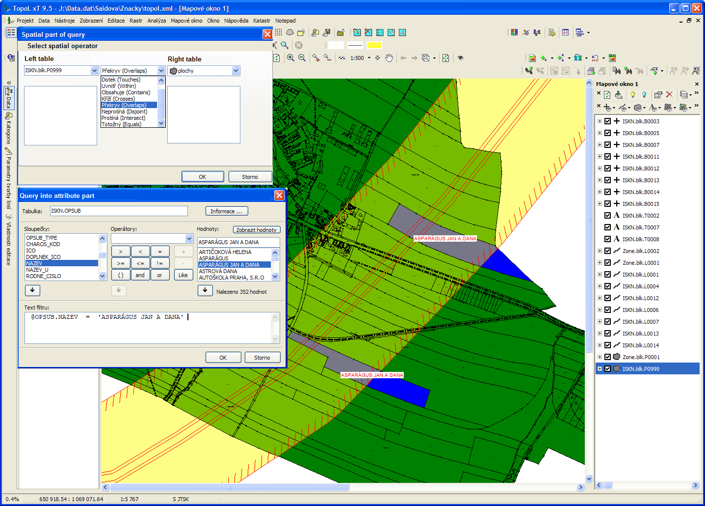
Combination of spatial and
attribute query
- topology in real time – because of that the data creation and data update is much faster than in other systems. You can see if the data are topologicaly correct when you finish the vectorisation, you do not have to run any special function to check the topology when you finish the vectorisation.
- analytical functions. Analytical functions of TopoL xT can find problematic parts of your data.
Benefits for you
Feature class definition
- complex work with data / Collect data, edit it and save to a file or database, analyze data
- vector and raster / Works directly with vector and raster data formats
- no conversions / Directly accesses the data without having to convert therm
- for a range of disciplines / Public administration, forestry, agriculture, etc.
- export data to Google Earth, both raster and vector
- database / We support most used database systems (Oracle, Microsoft SQL Server, PostgreSQL, Microsoft Access)
- GNSS / Import and export data to and from GNSS devices. Possibility of direct connection of GNSS devices
- Data Analysis / Spatial analysis of graphic and attribute data
- user-friendly GUI / Customize your GUI of the program to suit you
Why to decide for TopoL xT
You can use TopoL xT in many fields where you need to create, update and process GIS data.
Data viewing is for free
You can use Topol Explorer to view your data. This variant of TopoL xT is free of charge and you can download it from our site for free.
Who is using TopoL xT
TopoL xT has many installations in governmental and commercial organisations.
Functionality
TopoL xT User Interface
TopoL xT can process both vector and raster data equally well and provide wide scale of vector and raster data manipulation and analysis methods. This functionality includes vector data overlays, database analyses as well as image rectification and mosaicking. Extensive care was focused on topology and support for topographic structures of vector data. Digitising capabilities of TopoL xT are easy to use and the system is able to solve topologic relations in real-time while data are digitised. TopoL can import and export data in many industry-standard formats. TopoL xT is running on standard PC computers in MS Windows environment. Czech, English, German, Italian, Spanish and Russian language mutations of the system are available.
Vector data
This vector data access technology eases the use of geographic data within complex information systems, data storage systems and any other systems supporting ADO (ActiveX Data Object) standard. TopoL xT enables data reading/writing from/to common systems TopoL Block, ArcView Shapefile, Microstation dgn, AutoCAD dwg, dxf, MapInfo MIF/MID, MapInfo TAB, Geomedia MDB, ESRI MDB, MS SQL, Oracle, PostGis..
vector data input:
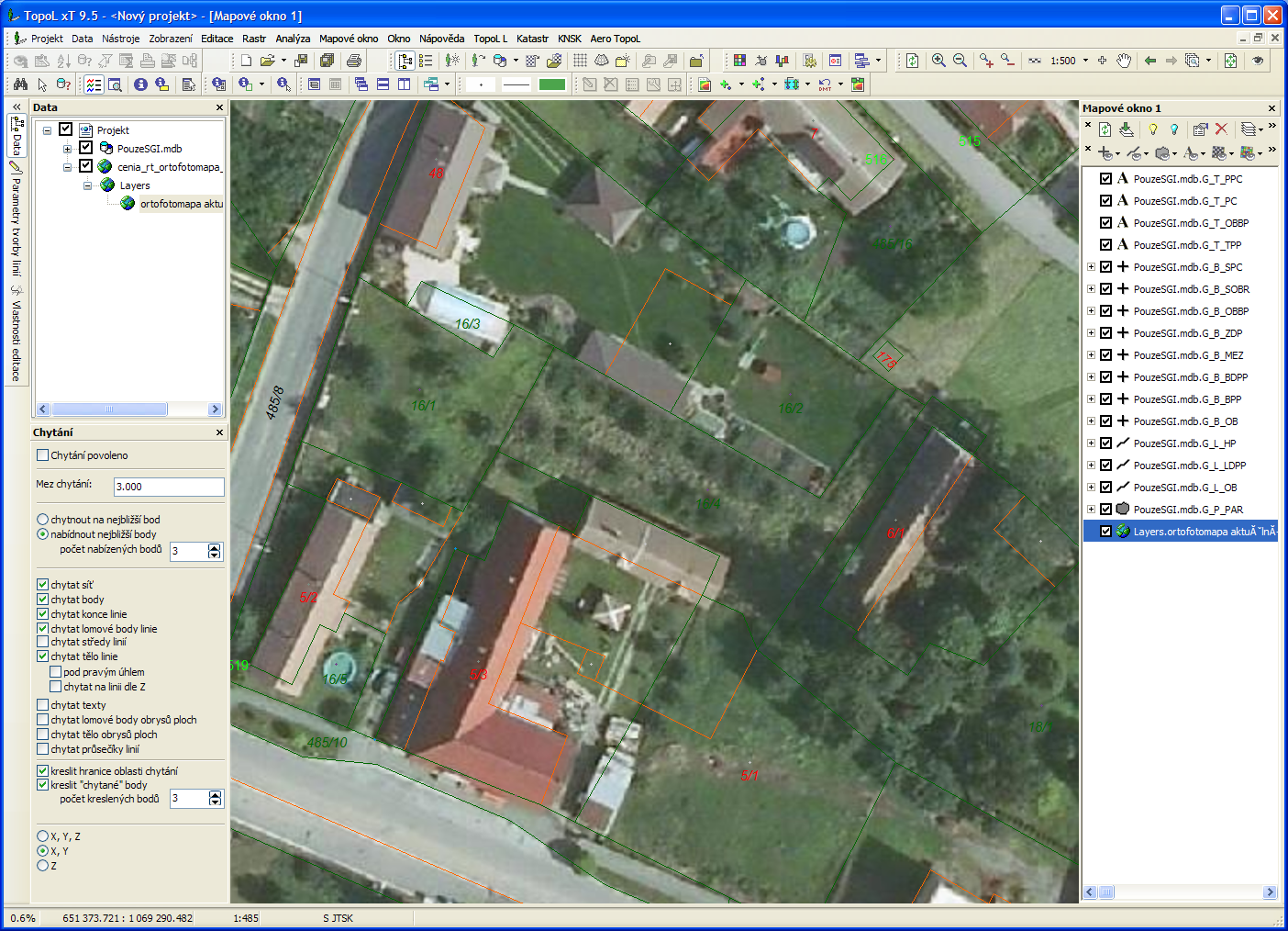
vector data digitizing of existing maps on digitiser vector data digitizing of raster images displayed on screen all vector editing tools are with various methods of snap and local zoom vector data import from common systems on-line input and off-line import of GPS data attribute import from text files and existing databases
vector data capabilities:
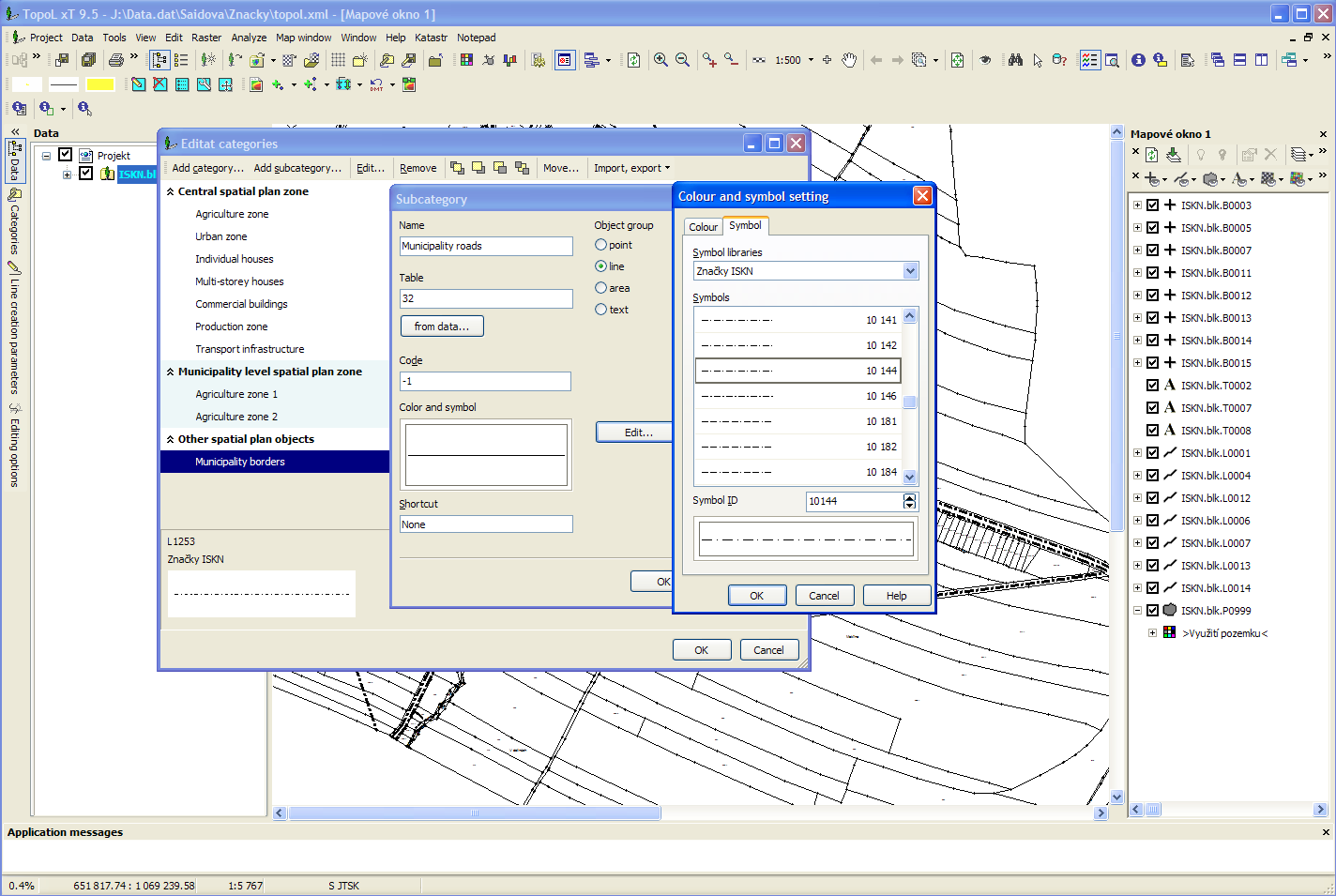
fully-fledged implementation of basic spatial topographic data structures (points, lines, texts and areas) object-oriented organisation of primitive data into object classes and topographic blocks (well-arranged heterogeneous layers) extensive care for topology and full support for topographic structures of vector data display, informative and functional adjustment of the system through internal programming language and various properties defined for each class of objects separately
vector data analyses:
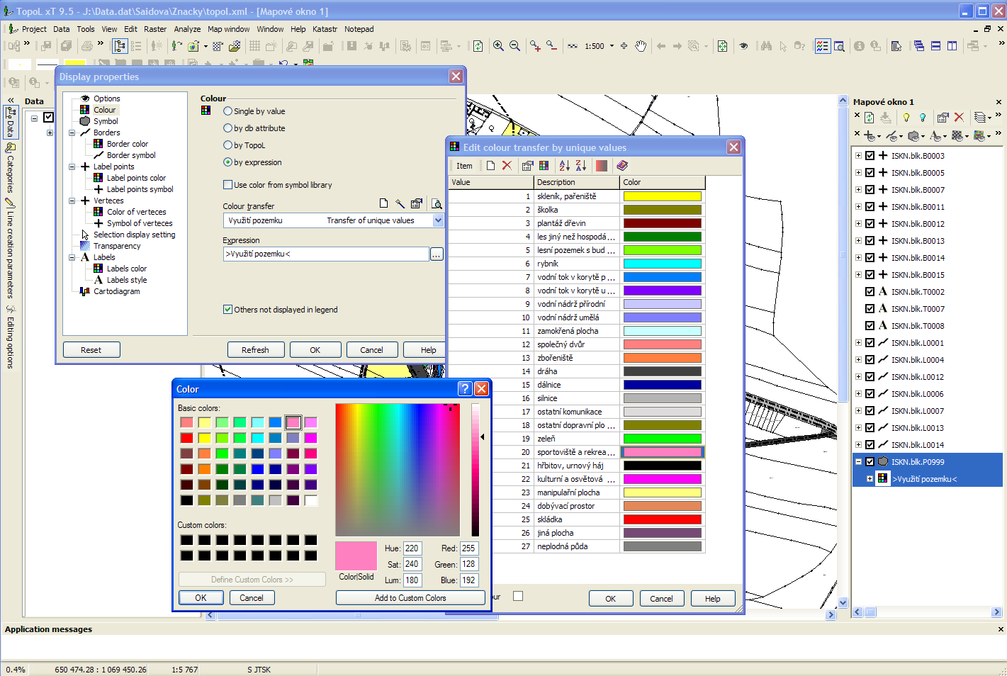
Thematic maps definition
various object and layer combinations areas overlay areas aggregation attribute transfer between objects and blocks conversion of line and area objects into points buffers around objects set operators (union, intersection and subtraction) for area objects
attribute data capabilities:
class attribute definition for every class of vector objects separately in each block fully functional link to external databases with powerful support for one-to-many relations standard databases and existing information systems linked through user-defined database model without any change of existing data usual edit, display and query functions for attributes stored both in local and external databases
attribute data analyses:
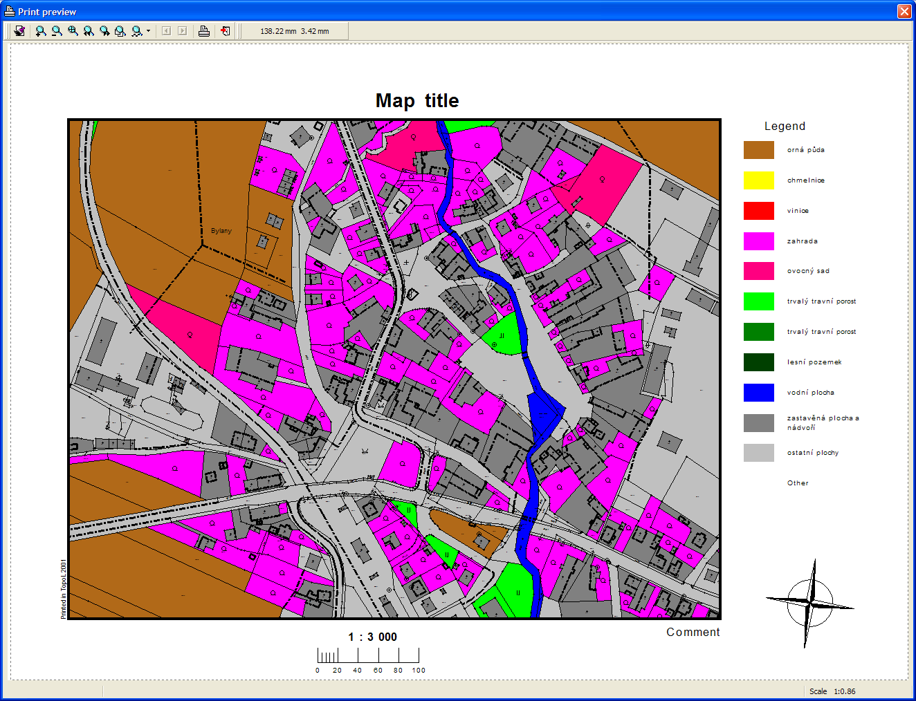
Print preview
database browser, easy-to-use query tool, attribute computations creation of thematic views and special maps through colour and style symbol definition based on attribute values vector data selection through attribute values user-defined forms for quick data retrieval and analyses within whole information system cartographic diagrams for visual presentation of analysis results
Raster data
Data connectors for raster data enable to read and write image files irrespective of their format. TopoL NT technology currently supports following image formats without any need for conversion: TopoL RAS (including RAK variant), TIFF, GeoTIFF, BMP, CIT, JPEG, JPEG 2000, GIF, PCX, Mr.SID, ECW, COT and others.
raster data capabilities:
handling of binary, grey-scale and colour raster images including huge files colour transfer look up table and palette definition and adjustment image processing tools: histogram equalisation, gamma correction, change of brightness and contrast, raster sharpenning, raster gradient correction full-featured geometric transformations (similarity, affinity, colinearity, polynomial quadratic and cubic) raster rotation, resampling, cutting, masking, and full-featured combination into mosaics with colour balancing
User customisation
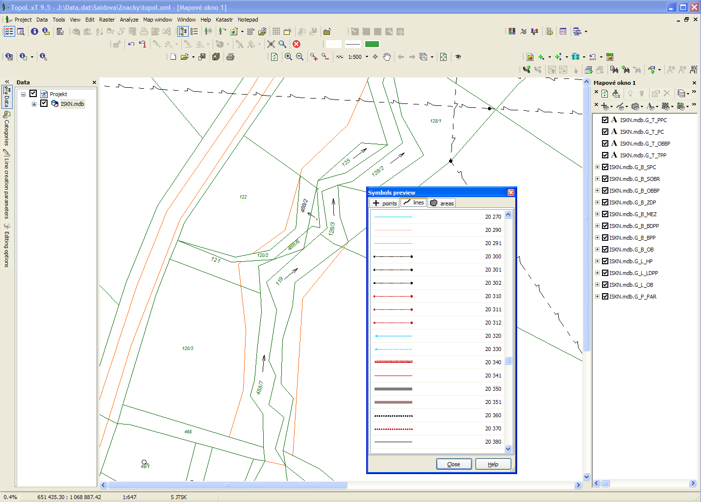
User symbols
The freedom TopoL xT offers, which includes the possibility to change user interface (menu, icons, hot keys), is very important. It is also possible to change editing tools or other functions very easily. This is due to the use of OLE/COM architecture for main component of the system and for all its key subsystems. Open fully documented interface of the system enables to add new OLE/COM objects developed in standard programming tools (Delphi, Visual Basic, Visual C++, etc.).
I want to test it
You can download and test TopoL xT. Without hardlock it will work as demo version. It means that you can display all supported data formats, but you can edit the TopoL block only up to the size of 500 objects (points, polylines, areas and texts together). Rasters can be changed up to the size of 4 milions pixels. It is not possible to print in scale. If you decide to buy TopoL xT, you can just order it and we will send you the hardlock. You do not have to reinstall the program.