PhoTopoL
PhoTopoL je systém pro zpracování fotogrammetrických a GIS dat. Obsahuje moduly pro aerotriangulaci, stereo vyhodnocování, ortofoto a mozaikování s barevným vyrovnáváním. Více informací je možno nalézt na stránkách www.photopol.cz.
Definice projektu
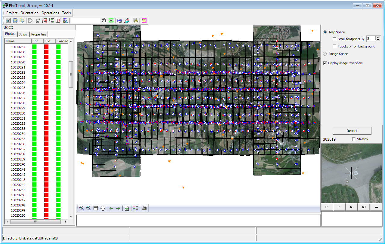
uživatelské rozhraní PhoTopoLu
Data jsou organizována do projektů. Každý projekt zahrnuje definici komory, snímků v projektu a definici bloku snímků. Interní a externí orientace může být provedena přímo ve PhoTopoLu nebo mohou být importovány z jiných softwarů (Bingo, AeroSys, ImageStation, Erdas, DiAP, PatB, ASCII souborů, Zeiss výměnný formát PEX).
Digitální aerotriangulace
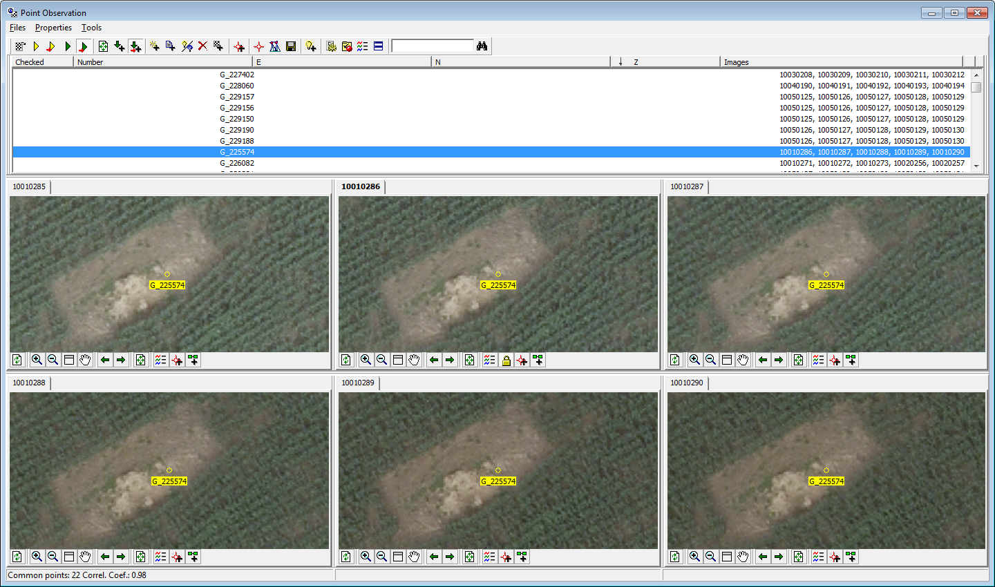
editor spojovacích bodů
Předtím než je možno provést stereo vyhodnocování, ortofoto překreslení nebo automatické generování bodů pro DMT, je potřeba provést orientaci snímků. Nejdříve se musí provést nastavení parametrů projektu (kamera a to jak analogová, tak digitální, snímky v projektu atd.). Potom se musí provést interní orientace snímků. PhoTopoL umožňuje provést interní orientaci snímku automaticky pomocí korelace. Potom je nutno provést sběr vlícovacích a spojovacích bodů stereo modelu nebo bloku snímku. PhoTopoL umožňuje provádět sběr spojovacích bodů ručně po jednotlivých stereo modelech s pomocí korelace nebo automaticky, pomocí unikátních algoritmů. PhoTopoL provádí automaticky sběr náčrtků jednotlivých vlícovacích bodů. Výpočet aerotriangulace může být proveden v programu Bingo nebo AeroSys.
Stereo zobrazování
Stereo zobrazování je umožněno na speciálních grafických kartách, které podporují stereo zobrazování. Vektorová data mohou nebo nemusí být zobrazena přes stereo snímky. Stejně tak mohou být zapínány jednotlivé vrstvy vektorových dat. Na tomto monitoru se mohou také zobrazovat souřadnice stereo kurzoru. Stereo zobrazování (pohyb v rámci stereo modelu, změna měřítka atd.) je velmi rychlé. Pozice stereo kurzoru je zobrazena také v mapovém okně na mono obrazovce.
Software pro sběr a editaci vektorových dat
Sběr a editace vektorových dat je prováděn v programu TopoL xT. TopoL xT je obecný GIS, který je používán v mnoha oblastech. Umožňuje tvorbu, údržbu, analýzy a zobrazování geografických dat. Největší výhodou TopoLu xT je, že již při sběru a editaci dat jsou řešeny topologické otázky. To znamená, že TopoL xT zamezuje tvorbě duplicitních čar, nedotahů, přetahů atd. Tuto funkčnost je samozřejmě možno vypnout. Vektorizační funkce jsou velmi jednoduše použitelné a umožňují jednoduché řešení všech možných případů. Je zde možnost chytání se na již existující objekty a to chytání jak všech tří souřadnic, tak například pouze polohy nebo pouze výšky. Speciální nastavení dále umožňuje vektorizovat linie s tím, že jsou vždy pravoúhlé.
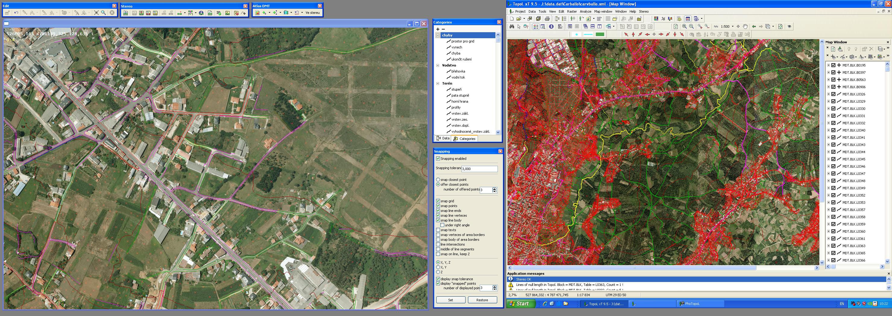
prostředí TopoLu xT s otevřeným stereo oknem
Automatické generování DMT

před zhlazením
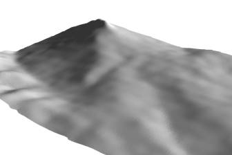
po zhlazením
Ortofoto překreslení a mozaikování s automatickým vyrovnáním barev
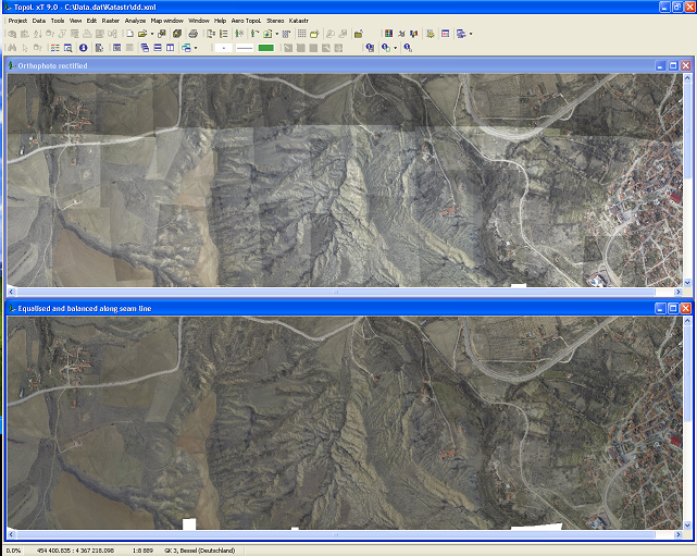
barevné vyrovnání